
8.9· 14 reviews
Pipa Beach Day Trip
Visit Pipa, home to some of the beaches in all of Brazil. This trip will take you to the golden sands of Madeiro and Love Beach.
9 h 30 min
from US$ 24
Natal deserves 4 to 5 days: enough for the city beaches, the Genipabu dunes and the Pirangi cashew tree, with time left for a day trip to Maracajaú or Pipa. The best window runs from September to December, with highs of 29 to 30 °C and 21 to 54 mm of rain a month; from April to July it rains much more (349 mm over 18 days in June).
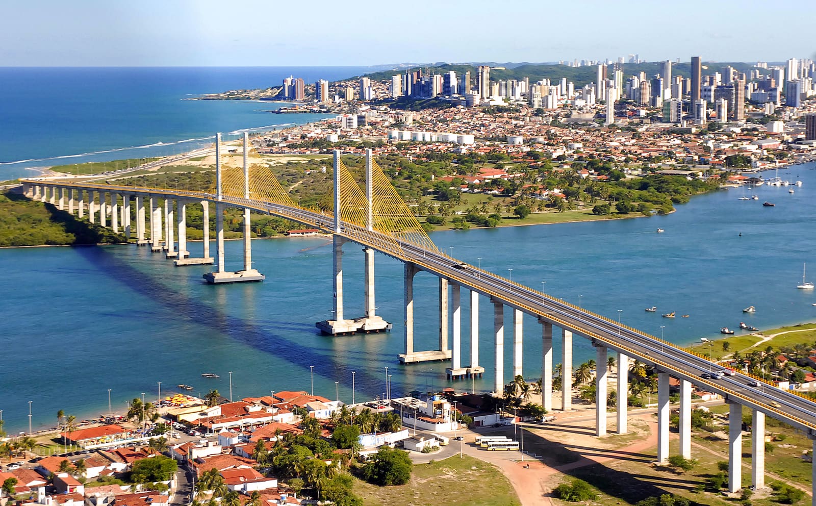
Natal is the Brazilian state capital with the most days of sun, and its fame as the "City of the Sun" is not marketing: the sky is clear most of the year, with rain concentrated in fall and winter. The city was born on Christmas Day in 1599, beside the Forte dos Reis Magos (Three Kings Fort), which the Portuguese built at the mouth of the Potengi River to hold off the French and the Dutch, who coveted the brazilwood of the coast. That star-shaped fort, set on a sandbank that appears only at low tide, is still the city's point zero (marco zero).
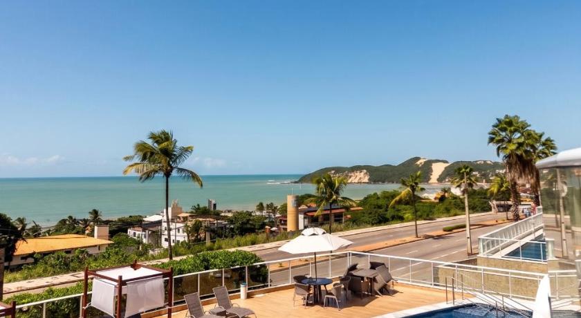
What really defines Natal are the dunes. At Genipabu, to the north, the sand forms moving hills that advance over lagoons, and the buggy ride with an authorized driver is the signature outing: the driver asks "with or without emotion?" and the answer changes the descent completely. To the south, Ponta Negra Beach is guarded by the Morro do Careca, a dune more than 100 meters high resting against a wall of Atlantic Forest, now protected and closed to climbing precisely so that it does not collapse.
Natal is also a base for a few records and oddities. In Pirangi do Norte stands the World's Largest Cashew Tree, a single tree that, due to a genetic anomaly, grows lying down and covers almost 9,000 square meters: you walk beneath it as if it were a grove. Farther north, the Maracajaú reefs (parrachos) form natural reef pools kilometers from the coast, and, to the south, Pipa Beach, already in the municipality of Tibau do Sul, rounds out the list with cliffs, dolphins and a nightlife that contrasts with the calm of the rest of the coast.
Updated on October 19, 2026
The liveliest beach in the city, with a seaside promenade, kiosks and the Morro do Careca in the background, a giant dune resting against the Atlantic Forest, now protected and closed to climbing.
The classic buggy ride of Brazil's Northeast, with an authorized driver descending moving dunes between lagoons. Before each descent the driver asks "with or without emotion?".
A star-shaped fort built at the mouth of the Potengi, on a sandbank that appears only at low tide. It is Natal's founding landmark.
In Pirangi do Norte, a single cashew tree that grows lying down because of a genetic anomaly and covers almost 9,000 square meters. You walk beneath it as in a grove.
Natural reef pools kilometers from the coast, with warm, clear water for snorkeling and diving among colorful fish. You get there by catamaran.
Already in Tibau do Sul, south of Natal, it brings together cliffs, the dolphin bay, lookouts and a village with nightlife that contrasts with the calm of the rest of the coast.
Brazil is in the Southern Hemisphere, so the seasons are reversed compared with Europe and North America: summer runs from December to March and winter from June to August. In Natal you barely notice the change of season: from December to March highs are 30 to 31 °C and lows 24 to 25 °C, and in July, the coolest month, the average high is 28 °C and the average low is 21 °C.
Rain is what makes the difference. The driest months are October, with 21 mm over 5 days, November, with 23 mm over 4 days, and December, with 29 mm over 5 days. The wettest are June, with 349 mm over 18 days, July, with 254 mm over 16 days, and April, with 240 mm over 16 days.
The most favorable window runs from September to December. September to February is the driest and sunniest part; from March to July it rains more, peaking in June. No month guarantees the weather, but the heat lasts all year.
| Month | High | Low | Rain | Rainy days | Rating |
|---|---|---|---|---|---|
| January | 30 °C | 24 °C | 81 mm | 7 | Good |
| February | 31 °C | 25 °C | 100 mm | 8 | Fair |
| March | 31 °C | 24 °C | 201 mm | 13 | Not recommended |
| April | 30 °C | 24 °C | 240 mm | 16 | Not recommended |
| May | 30 °C | 23 °C | 222 mm | 15 | Not recommended |
| June | 29 °C | 22 °C | 349 mm | 18 | Not recommended |
| July | 28 °C | 21 °C | 254 mm | 16 | Fair |
| August | 29 °C | 21 °C | 119 mm | 12 | Fair |
| September | 29 °C | 22 °C | 54 mm | 8 | Good |
| October | 30 °C | 24 °C | 21 mm | 5 | Good |
| November | 30 °C | 24 °C | 23 mm | 4 | Good |
| December | 30 °C | 25 °C | 29 mm | 5 | Good |
Monthly averages for 1991-2020 from INMET (Brazil's National Institute of Meteorology). The rating combines rainfall, temperature and humidity.
In summer (December to February), Natal has highs of around 30 °C (86 °F) and lows of 25 °C (77 °F), and it is the wetter season, with about 70 mm of rain spread over about 7 days a month. The days are hot and call for beach time and shade.
In fall (March to May), Natal has highs of around 30 °C (86 °F) and lows of 24 °C (75 °F), and it is the wetter season, with about 221 mm of rain spread over about 15 days a month. The days are hot and call for beach time and shade.
In winter (June to August), Natal has highs of around 29 °C (84 °F) and lows of 21 °C (70 °F), and it is the wetter season, with about 241 mm of rain spread over about 15 days a month. The days are hot and call for beach time and shade.
In spring (September to November), Natal has highs of around 30 °C (86 °F) and lows of 23 °C (73 °F), and it is the driest time of year, with about 33 mm of rain a month. The days are hot and call for beach time and shade.
Weather, crowds, prices and what is happening at the destination in each period. Tap a month to open its full page; the colored dot shows how good the time is for a visit.
One of the country's biggest micaretas (off-season Carnivals), held in December with trios elétricos (sound trucks) at the Arena das Dunas.
Recurring annual events: exact dates change every year, so confirm them before you plan your trip.
The gateway from abroad is Natal International Airport (NAT), in São Gonçalo do Amarante, about 26 km from the city. The last leg is by road. Routes and airlines change often; the safest approach is to check them when planning your trip.
By road, Natal is 185 km from João Pessoa (about 2.5 hours, on the BR-101) and 284 km from Recife (about 4 hours).
Ponta Negra is the liveliest beach in the city, with a seaside promenade and kiosks, and the Morro do Careca in view. The Genipabu dunes are to the north, and Pipa Beach, about 80 km to the south (about 1.5 hours by car), has a charm of its own: many people prefer to sleep there for at least one night. Since the attractions are spread along the north and south coast, it is best to choose your lodging according to the side where you will spend more time.
Rates change with the dates: confirm the price on Booking.com.
Almost. It is one of Brazil's state capitals with the most hours of sun. Rain is concentrated from March to July, peaking in June (349 mm over 18 days); from September to February it rains very little.
Yes, it is the most emblematic outing in the region. Always hire a driver authorized by Setur-RN and choose between the "with emotion" route (extreme descents) or "without emotion".
Yes, it is about 80 km to the south (about 1.5 hours by car). But Pipa has a charm of its own and many people prefer to sleep there for at least one night.
No. Climbing was banned decades ago to prevent erosion of the dune, which is now protected and covered with vegetation. You admire it from Ponta Negra Beach.
Four to five days is enough for the city beaches, the Genipabu dunes and the Pirangi cashew tree, with time left for a day trip to Maracajaú or Pipa.
It helps a lot. The attractions are spread along the north and south coast. Without a car, you can combine agency tours with ride-hailing apps.
The weather and population data in this guide come from official agencies and open databases. Entry requirements and health recommendations change: always check the official source linked.