
9.4· 14 reviews
Monte Verde 4x4 Tour
On this 4x4 tour through Monte Verde, culture and nature combine as we get to know the Mantiqueira Mountains and its local traditions.
4 h
from US$ 467
Monte Verde deserves 2 to 3 days: enough for a walk through the village center, one or two hikes and unhurried winter dining. The best window runs from June to September, with highs of 18 to 20 °C and lows of 5 °C between June and August, and 38 to 46 mm of rain in the three driest months; summer is wetter (253 mm over 21 days in January).
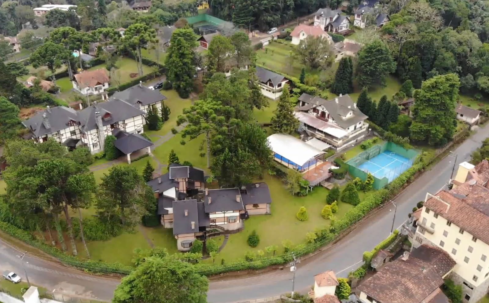
Monte Verde is not a city: it is a district of Camanducaia, in the far south of Minas Gerais, right on the border with São Paulo. Settlement began in the 1940s, with German and Latvian immigrants drawn by the cold climate and by the landscape's resemblance to Europe. What remains of that origin is the look the village keeps to this day: half-timbered houses, steep roofs and the Bauernmalerei, a decorative painting technique recognized as intangible heritage of Camanducaia. At more than 1,500 meters of altitude, it is the second-highest settlement in Brazil, behind only Campos do Jordão, and it inherited the same nickname: the Brazilian Switzerland.
The altitude guarantees real cold. On winter mornings before dawn the temperature often hovers around 0 °C, with frequent frost, and a heavy coat is a must even in summer, when mist rises from the araucaria forest at dusk. In that cold, the village lives on fondue, lit fireplaces and craft breweries, almost all of them concentrated on Avenida Monte Verde, the small center with knitwear shops, chocolate shops and restaurants. July is the busiest month: the Inverno nas Montanhas (Winter in the Mountains) festival takes over the streets for four Saturdays in a row with free concerts, and the village fills with crowds. Book lodging and trails well in advance for that month and for long holiday weekends.
Away from the center, what draws visitors are the stone trails of the Verner Grinberg Ecological Park. Pedra Redonda is the shortest, open to the public with online tickets, and ends on a flat summit with a 360° view. Chapéu do Bispo and Pedra Partida can only be visited with an authorized agency, but reward you with rock formations and panoramas of the Mantiqueira. The Platô trail adds views of the Paraíba Valley to a stretch of uneven stones that calls for attention. If you prefer adrenaline to hiking, head to Fazenda Radical for ziplines and a treetop rope course. And if you just want to take in the view, go up to the former airport, now closed, the highest in Brazil at 1,560 m, today a lookout and a sure bet for sunset.
Updated on October 19, 2026
The best-known trail in Monte Verde: 926 m, with a wooden platform halfway along and a flat summit with a 360° view. Access is with a ticket bought online.
A rock formation more than 10 m tall that resembles a bishop's hat, in the Pedra Redonda Ecological Park. From the top you see the valley and the border marker between Minas Gerais and São Paulo. Access only with an authorized agency.
The village's second most popular trail, 1,250 m long with several lookouts along the way, from which you can see Pedra Redonda, Pedra Partida and the airport runway down below.
A 3.8 km route along the ridge of the Serra dos Poncianos, with a 360° view toward Pedra do Baú and the Paraíba Valley on clear days. Moderate to hard, it is only open with an authorized agency.
About 1 km long, with most of the village's shops, chocolate shops, breweries and fondue restaurants. This is also where the Inverno nas Montanhas festival takes place, in July.
An adventure park with a mega zipline of more than 1 km counting both sections, a treetop course, climbing and horseback riding in the mountain forest.
The former Monte Verde airport, now closed, is the highest in Brazil, at 1,560 m. It became a lookout with a view of the mountains and the araucaria trees, especially popular at sunset.
Brazil is in the Southern Hemisphere, so the seasons are reversed compared with Europe and North America: summer runs from December to March and winter from June to August. In Monte Verde summer is mild, with highs of 22 to 23 °C and lows of 13 to 14 °C, and winter is cold: in June and July, the coolest months, the average high is 18 °C and the average low is 5 °C. The reference climate is that of the Campos do Jordão station, in the same Serra da Mantiqueira and at a similar altitude.
The driest months are June and August, with 38 mm of rain over 4 days each, followed by July, with 46 mm over 4 days. The wettest are January, with 253 mm over 21 days, December, with 240 mm over 19 days, and February, with 206 mm over 16 days.
The most favorable window runs from June to September. July brings the most intense cold and the Inverno nas Montanhas festival, but it is also the busiest month; May, June and August offer cold weather with fewer people. Even if you arrive in summer, bring a heavy coat: because of the altitude, the night turns cold at any time of year.
| Month | High | Low | Rain | Rainy days | Rating |
|---|---|---|---|---|---|
| January | 23 °C | 14 °C | 253 mm | 21 | Fair |
| February | 23 °C | 14 °C | 206 mm | 16 | Fair |
| March | 22 °C | 13 °C | 197 mm | 17 | Not recommended |
| April | 21 °C | 11 °C | 86 mm | 9 | Fair |
| May | 19 °C | 8 °C | 83 mm | 7 | Fair |
| June | 18 °C | 5 °C | 38 mm | 4 | Good |
| July | 18 °C | 5 °C | 46 mm | 4 | Good |
| August | 20 °C | 5 °C | 38 mm | 4 | Good |
| September | 20 °C | 8 °C | 86 mm | 8 | Good |
| October | 21 °C | 10 °C | 133 mm | 12 | Fair |
| November | 22 °C | 12 °C | 161 mm | 14 | Fair |
| December | 22 °C | 13 °C | 240 mm | 19 | Fair |
Monthly averages for 1991-2020 from INMET (Brazil's National Institute of Meteorology). The rating combines rainfall, temperature and humidity.
In summer (December to February), Monte Verde has highs of around 23 °C (73 °F) and lows of 14 °C (57 °F), and it is the wetter season, with about 233 mm of rain spread over about 19 days a month. The weather is milder, good for walking and exploring without the summer heat.
In fall (March to May), Monte Verde has highs of around 21 °C (70 °F) and lows of 11 °C (52 °F), and it is the wetter season, with about 122 mm of rain spread over about 11 days a month. The weather is milder, good for walking and exploring without the summer heat.
In winter (June to August), Monte Verde has highs of around 19 °C (66 °F) and lows of 5 °C (41 °F), and it is the driest time of year, with about 41 mm of rain a month. The weather is milder, good for walking and exploring without the summer heat.
In spring (September to November), Monte Verde has highs of around 21 °C (70 °F) and lows of 10 °C (50 °F), and it is the wetter season, with about 127 mm of rain spread over about 11 days a month. The weather is milder, good for walking and exploring without the summer heat.
Weather, crowds, prices and what is happening at the destination in each period. Tap a month to open its full page; the colored dot shows how good the time is for a visit.
The winter festival takes over Saturdays with free concerts of classical and popular music, theater and dance. It is the peak of the season.
Workshops and exhibitions of Bauernmalerei, the decorative painting of German origin that is intangible heritage of the region.
Avenida Monte Verde gets themed lighting and the Vila do Noel (Santa's Village), with dozens of attractions spread across the village.
Recurring annual events: exact dates change every year, so confirm them before you plan your trip.
The nearest gateway from abroad is Viracopos International Airport (VCP), in Campinas, about 150 km from Monte Verde. The last 30 km are mountain road, climbing from Camanducaia to the village. As an alternative, Guarulhos International Airport (GRU), in Guarulhos, is about 195 km away. Routes and airlines change often; the safest approach is to check them when planning your trip.
From there the last stretch is by road: from São Paulo, 165 km (about 2.5 hours), on the Fernão Dias highway (BR-381) to Camanducaia, then 30 km uphill to the center; from Campinas, 156 km (about 2.3 hours); from Belo Horizonte, 484 km (about 6.1 hours); and from Campos do Jordão, 82 km (a little over 2 hours). You can also arrive by van or on a group excursion from São Paulo or Campinas.
Within the district there is no significant public transportation, and the trails and lookouts are spread across the mountains, so a car or a hired van makes getting around much easier.
Most of the shops, restaurants, chocolate shops and breweries are on Avenida Monte Verde, the small center. Staying near that avenue lets you walk to dinner and stroll around, while the trails, the former airport lookout and Fazenda Radical are spread across the mountains and reached by car. In July, during the Inverno nas Montanhas festival, and on long holiday weekends, the village fills up. It is best to book lodging in advance, and the trails too.
Rates change with the dates: confirm the price on Booking.com.
No. Monte Verde is a district of the municipality of Camanducaia (Minas Gerais), with no city hall of its own. In practice it works as a separate tourist village, with its own commercial life on Avenida Monte Verde.
No snow has been recorded in the region. What does happen often in winter is frost and temperatures close to 0 °C on the coldest mornings before dawn, which is enough to justify a fireplace and heavy clothing.
June to September is the most favorable window, with highs of 18 to 20 °C and little rain. July brings the strongest cold and the Inverno nas Montanhas festival, but also the biggest crowds. May, June and August have cold weather with fewer people.
Two to three days is enough to walk through the village center, do one or two trails and enjoy winter dining without hurrying.
It depends on the trail. Pedra Redonda and Platô can be done on your own with a ticket bought in advance; Chapéu do Bispo and Pedra Partida are only allowed with an authorized travel agency.
You can arrive by van or on a group excursion leaving from São Paulo or Campinas. But to get around within the district, with trails, lookouts and Fazenda Radical spread across the mountains, your own car or a hired van makes things much easier.
The weather and population data in this guide come from official agencies and open databases. Entry requirements and health recommendations change: always check the official source linked.


